South Downs WalksWalking Routes & Hiking Trails
Find South Downs walks from the list below which features the best walking routes in the area. Most are circular walks and are listed from the shortest and easiest to the longest more challenging routes.
The South Downs National Park walks listed below cater for walkers of all abilities from easy low-level circular walks to long day walks across the downs. All walks are free to download and print and all routes have GPX files. The walks cover some sections of the South Downs Way and other long distance footpaths that cross the region.
| Walk | Description | Grade | Miles |
|---|---|---|---|
| 3575★ | High and Over White Horse | easy | 2.00 |
| 3488★ | Devil's Dyke Circular | easy | 2.50 |
| 1633★ | Charleston Farm & Firle Beacon | easy/mod | 4.60 |
| 1629★ | The River Arun & South Stoke from Amberley | easy | 4.60 |
| 3548★☩ | Stoughton, Kingley Vale & Bow Hill from Stoughton Down | easy/mod | 5.20 |
| 1425★ | Midhurst Way - Petworth to Midhurst | easy/mod | 5.50 |
| 1835★ | Treyford & Didling from Hooksway | easy/mod | 6.00 |
| 2232★ | Midhurst and Woolbeding from Easebourne | easy/mod | 6.00 |
| 1983★ | Edburton Hill from Fulking | easy/mod | 6.10 |
| 1638★ | Beachy Head & Eastbourne from East Dean | easy/mod | 6.20 |
| 2835★ | Arundel to Amberley | easy | 6.20 |
| 1872★ | Charlton, Singleton & Goodwood Circular | easy/mod | 6.50 |
| 1917★ | Rackham Hill from Amberley | easy/mod | 6.50 |
| 3464★ | Rackham Hill & Kithurst Hill Circular | easy/mod | 6.70 |
| 1770★ | Southease or Rodmell to Falmer | easy/mod | 6.75 |
| 2109★ | Upper Beeding to Washington by the South Downs Way | easy/mod | 7.00 |
| 3080★ | Arundel Park and the River Arun | easy/mod | 7.20 |
| 1667★ | Blackpatch Hill & Harrow Hill from near Storrington | easy/mod | 7.20 |
| 1782★ | Steyning Round Hill and No Man's Land | moderate | 7.50 |
| 2486★ | Plumpton Green & South Downs | easy/mod | 7.70 |
| 3305★ | Amberley Mount and Wepham Down from Burpham | easy/mod | 8.00 |
| 3213★ | Pyecombe, Devil's Dyke & Upper Beeding | easy/mod | 8.00 |
| 2394★ | East Meon & Wether Down | easy/mod | 8.00 |
| 3078★ | Cissbury Ring & Chanctonbury Ring from Washington | easy/mod | 8.25 |
| 1628★ | Bignor Hill and The Denture from Amberley | moderate | 8.70 |
| 2684★ | Falmer to Pyecombe & Blackcap by South Downs Way | moderate | 8.75 |
| 3120★ | Alfriston to Rodmell by the South Downs Way | moderate | 9.00 |
| 1424★ | Midhurst Way - Haslemere Stn to Midhurst Bus Stn | moderate | 9.50 |
| 3574★☩ | Firle Beacon & Cuckmere Valley | moderate | 10.40 |
| 1858★ | Cissbury Ring and Chanctonbury Ring from Steyning | moderate | 10.50 |
| 3487★☩ | Edburton Hill & Devil's Dyke from Saddlescombe | hard | 10.50 |
| 2227★ | East Dean Circular | moderate | 11.00 |
| 2236★ | Wolstonbury Hill and Pyecombe from Patcham | moderate | 11.00 |
| 2533★ | East Meon to Old Winchester Hill | moderate | 12.00 |
| 1015★ | Ouse Valley & Beddingham Hill from Newhaven Tide Mills | moderate | 12.00 |
| 3516★ | Eastbourne to Alfriston by the South Downs Way | mod/hard | 12.50 |
| 2422★ | Butser Hill and Wether Down from Buriton | moderate | 12.50 |
| 1888★ | Cissbury Ring, Chanctonbury Ring & Coombes | moderate | 12.50 |
| 2903★ | Stanmer to Streat | moderate | 12.50 |
| 3310★ | Washington to Littleton Farm by the South Downs Way | moderate | 13.00 |
| 1466★ | Amberley and Arundel Circular | moderate | 13.00 |
| 1038★ | Firle Beacon from Southease | moderate | 13.25 |
| 1357★ | The Seven Sisters from Exceat | moderate | 14.00 |
| 2419★ | Southease, Ditchling Beacon & Lewes | mod/hard | 17.00 |
| 1423★ | Midhurst Way - Arundel to Midhurst | mod/hard | 19.00 |
| 1615★ | Amberley & East Dean Circular | mod/hard | 21.00 |
★ GPS file ☩ Route profile
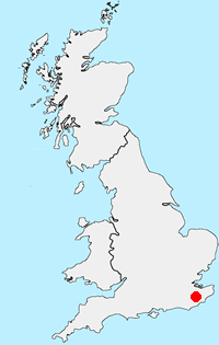
Location Map
South Downs Guide
The South Downs is Britain's newest National Park and stretches from Winchester to Beachy Head. Steeped in history there are ancient hill-forts, barrows, a Roman road and deserted medieval villages. The area has a rich diversity of natural habitats including flower-studded chalk grassland, ancient woodland, flood meadow, lowland heath and the particularly rare chalk heathland. This varied environment provides an excellent basis for those who enjoy outdoor pursuits, such as walking, cycling and horse riding.
South Downs Walking Guide
Other walks in Britain - For a list of all the areas where walks are available go to the Main Walk Index.
Walk grading - Learn how each walk is assessed and select a walk to suit your ability and experience by going to Walk Grading Details.
Messaging & Social Media
Message Walking Britain and follow the latest news.

Mountain Weather
Stay safe on the mountains with detailed weather forecasts - for iOS devices or for Android devices.